
History of Spring City
Spring City lies in the northern half of Sanpete Valley, about seventeen miles north of Manti, the Sanpete county seat. U. S. 89, the principal route through the valley, bypasses the town one mile to the west. Spring City is tucked beneath the Wasatch Plateau, which rises dramatically on the eastern perimeter of the town. A line of low-lying limestone hills to the south and west effectively cut the town off from the larger valley. Spring City is one of eleven existing settlements located in the upper Sanpete Valley of central Utah. Each of these settlements figures in the overall colonization of the area by members of the Church of Jesus Christ of Latter-day Saints (Mormons) in the years after 1849. Mormon town planning in the Sanpete Valley closely followed an agricultural village system advocated by the LDS church leadership. By this design, dwellings were clustered together in town, which in turn were surrounded by individual farm holdings. Such a village living arrangement strengthened church authority, fostered communitarian activity, and facilitated the defense of the population against Native American attack. Villages were plotted into five-acre blocks, with each family generally receiving a quarter-block allotment. On the town site, the Sanpete farm family erected a dwelling house, a barn, a granary, and other necessary outbuildings. While all eleven communities in the upper Sanpete Valley are products of this system of farm planning, Spring City best represents the original nineteenth and early twentieth century character of the settlements.
The town of Spring City is a National Register Historic District. The historical and architectural significance of Spring City lies in two areas: 1. The town graphically documents the techniques of Mormon town planning in Utah: and 2. Architecture in Spring City is remarkably well preserved with an abundance of religious buildings, homes, and small commercial establishments that predate World War I. In keeping with the religious nature of the town, Spring City is dominated by a large LDS meetinghouse. This elegant stone structure of oolitic limestone was built between 1902-1911, and replaced an earlier building. In the 1970’s, a wing built of the same stone was added to the north end. This sympathetic addition matches the character of Provo architect Richard C. Watkins’ 1900 design. Other buildings in the district related to the role of the L. D. S. Church include the Bishop’s Storehouse, the Relief Society Granary, and Orson Hyde’s office. Orson Hyde, LDS Apostle, resided here. Homes of other LDS church leaders include the James A. Allred house, the John Frantzen House, the Lauritz Larsen House the James T. S. Allred cabin and the Reid H. Allred House .
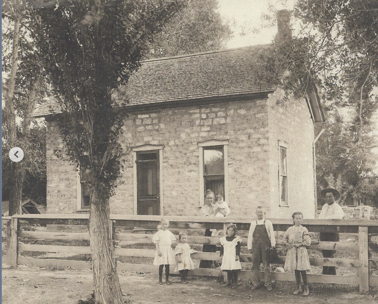
Outside these few buildings with strong religious links, and a small commercial area on Main Street, Spring City is predominantly residential. While there are newer residences and manufactured homes, the ambiance of the town remains strongly that of a rural farm village. Town lots retain a high percentage of their original out buildings such as barns, granaries, summer kitchens, root cellars, and chicken coops. Fields at the city’s edges continue to be planted with crops, and it is still possible to see large flocks of sheep being driven along the pring City streets. More recently large contemporary residences have been built north and south of the town on some of these original farm fields. Architecturally, the town is overwhelmingly vernacular in character. House types from the 1865-1890 period comprise over one third of the extant total, and range from one room cabins to two story hall and parlor and cross-wing houses. Oolitic limestone and adobe are the most common building materials, although brick, frame, and log are also in evidence. Nearly all of the barns and granaries follow traditional Mormon building patterns. The origins of the old design reflect the overall diversity of the settlement population.
Yankees and Southerners brought familiar house plans from their eastern homes, and Danes (a sizable percentage of the founding population) brought Scandinavian house types such as the parstuga, or pair house, having three contiguous rooms on one level. In general, vernacular styles predominate and generate much of the nineteenth and early twentieth Century quality of the town. Pattern book styles of the 1880-1910 period make up about another third of the town’s architecture. Economic prosperity during the later 19th century years enabled Spring City residents to emulate architectural fashions found in population centers like Salt Lake City and Provo. Carpenter-builder designs were made available in Sanpete Valley through architectural pattern books. As a result, hip roofs gradually replaced the simple gable roof, pyramid cottages with projecting gables became extremely popular, and several successful entrepreneurs created elegant monuments to their own prosperity. The John Baxter, Sr. house, the Emil Erickson house, the William Osborne house, the “King” Pedersen house and the Jacob Johnson house are picturesque renderings of the pattern book style.
Early twentieth century builder’s manuals also introduced the bungalow to Spring City. While a number of bungalows can be found within the town limits, these buildings make up only about one-tenth of the housing stock. Landscape features also enhance the historic village feeling of the town. The town is isolated from the main valley by two low-lying hills, known as the “stone quarry hills,” on the west. Streets are generally tree-lined and yards are maintained. Town lots contain orchards and vegetable gardens. The rich cream-colored, oolitic limestone used in the town’s buildings blends in particularly well with the cultivated landscape. The adobe, brick, and frame buildings are in harmony with the general setting. Natural features of importance are two creeks, which run through town. Canal Creek cuts through the extreme southeast corner of the town, and Oak Creek runs in a northwesterly course. One of the springs that gave the town its name can be seen north of the service station, although it is piped from the center of Main Street.
HISTORY
Spring City was settled as part of the colonization of the Great Basin, planned and directed by members of the Church of Jesus Christ of Latter-day Saints. In 1850, Brigham Young, LDS church president, and his counselor Heber C. Kimball, toured the Sanpete Valley and identified a good place to locate a city (Manti), as well as several other sites within the valley. Church leaders envisioned a line of settlements stretching the length of the Sanpete Valley to ensure the effective control of the area. Defensive measures were necessary in the valley due to the presence of a Native American population capable of resisting the intrusion of the Mormon colonizers. Though part of the larger plan for the settlement of the valley, the selection of Spring City’s location was largely James Allred’s decision.
Allred, born in 1784 in North Carolina, was an early convert; he and his large family followed the Church through its many persecutions. Arriving in Utah in the fall of 1851, he was advised by Brigham Young to move to Sanpete and “select a place for settlement where he could locate with his numerous posterity and kindred and preside over them.” (Hunter, 1940) On March 22, 1852, Allred and others explored the area along Canal Creek (southeast part of town). Four days later he returned with several of his sons and together with a number of men began settling the town. The first house, a log cabin, was situated on the southern edge of town on the east side of Main Street, near 500 South. During the summer of 1852, two adobe houses were constructed near the original log house, and the other near the spring. Also that summer, one of James Allred’s sons, James T. S. Allred, completed the first survey of the area. A tract of about 100 acres was divided into five-acre blocks. Some crops were planted and about 12 families spent the winter of 1852 in “Canal” or the “Allred Settlement.” In July of 1853, open warfare broke out between the Mormon settlers and the Native American population. Pleasant Creek (now Mount Pleasant) was raided in mid-July, and residents fled to the Allred settlement for safety. People from both towns created a fort-like structure by dragging their log cabins together and filling in the gaps between the houses with rock walls. The first “fort” was completed on July 28th, and stood on the block now containing the L. D. S. chapel. Native American attacks, resulting in considerable loss of livestock and horses, drove the defenders from the Allred settlement back to Manti on July 31st. An attempt to re-settle was made during the fall of 1853, with a large influx of Danish immigrants, but the town was still outnumbered by local tribes. The town was vacated, settlers going to Manti for a few months. Many of these hardy folks became the founders of Ephraim in the spring of 1854.
With Brigham Young’s approval, William Black, James T. Ellis, and the Allreds re-established the settlement in 1859. Albert Petty, county surveyor, accompanied them, laying off a town site and 640 acres of farmland around it, making five and ten acre lots available for distribution. A log meeting house was erected; this building housed a variety of activities until an adobe meeting house was erected in 1863-64. The community continued to attract many Danish immigrant converts, and the north end of town became known as “Little Denmark”. These Scandinavians made valuable contributions by their skills as tradesmen, bakers, blacksmiths, shoemakers, masons, etc. By 1860 the population of Spring Town was 243. Trouble with Native Americans continued until treaties were signed in 1869. Townspeople, with life more secure, turned full attention to agriculture, stock raising, lumbering, wool growing, and mercantile efforts. Spring City was incorporated in 1870. The coming of the railroad in 1890 made exporting and importing of products and goods much more available.
SIGNIFICANCE
In town plan and in the distribution of farmland, Spring City, (like other communities in the valley) adheres to a “farm village” system advocated by LDS church leaders. According to the village scheme, houses, barns, vegetable gardens, and orchards would be contained within the boundaries of the village. The large town lots, just over an acre, accommodated these buildings, domestic activity, and encouraged self-sufficiency. Farmland lay outside the village, with farmers commuting daily to their outlying fields. This activity continues today. In Utah the basis of this farm village is the Mormon prophet Joseph Smith’s “plat for the city of Zion.” Smith’s “plat” basically called for a gridiron block arrangement, blocks divided into lots, center blocks reserved for church buildings, wide streets, houses of brick or stone, and the town surrounded by fields. While some scholars have disputed the claim that Smith’s “plat” influenced town planning in Utah, it appears the LDS planners in Utah realized the “general principles” of the “plat of the city of Zion” even if their interpretations were never literal. While non-Mormon western ranchers chose the isolated farmstead, the Saints opted for the controlled atmosphere of the nucleated village. If mining boomtowns grew in a haphazard fashion, the Mormon village was nurtured to maturity by the application of specific planning rules. Spring City is historically significant as an outstanding example of this “village” settlement type. However, there were exceptions. The Charles Crawforth house and farm (#16A) is such an exception to the village pattern of Spring City. Vernacular domestic architecture predominates with a large number of houses and outbuildings constructed of oolitic limestone. As in any contemporary town non-contributory buildings do exist, but these do not distract from the obvious historical nature of Spring City.